
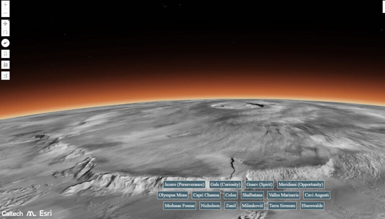
NASA has released a new interactive map of Mars, which was developed using over 100,000 images taken by the Mars Reconnaissance Orbiter. The map, which was created by scientists at the California Institute of Technology’s Planetary Visualization Laboratory, offers a panoramic view of the Red Planet in black and white, with 5.7 billion pixels.
The Most Detailed Global Portrait of Mars Yet
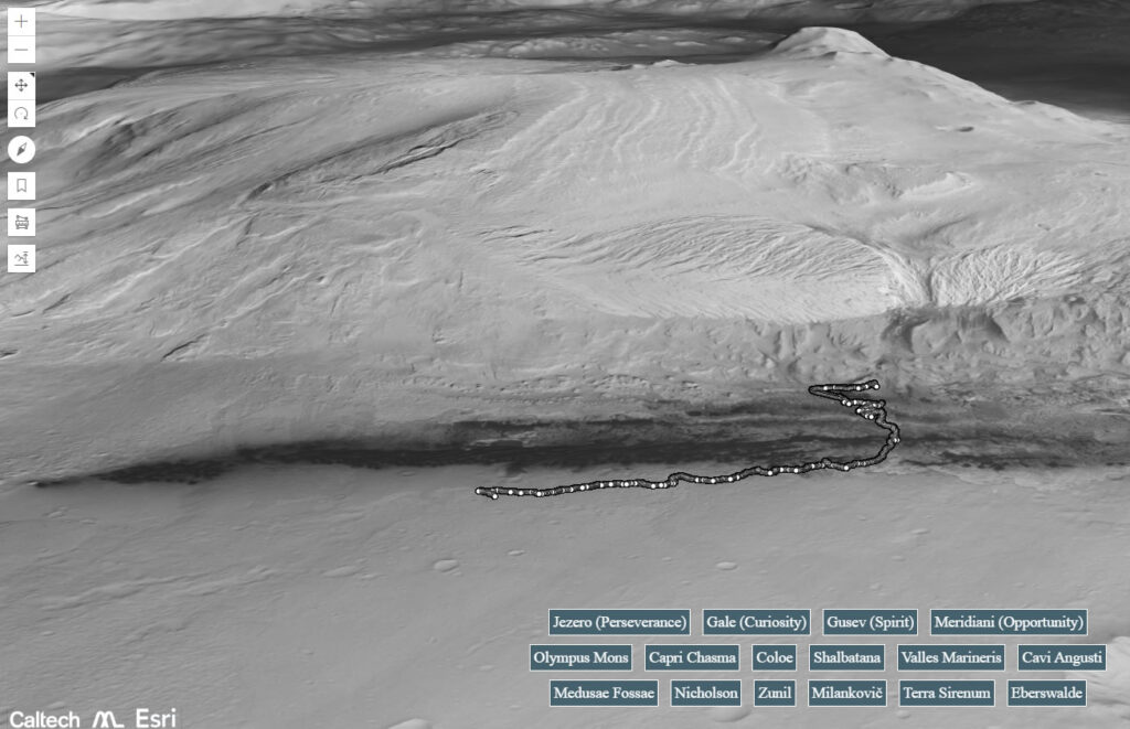
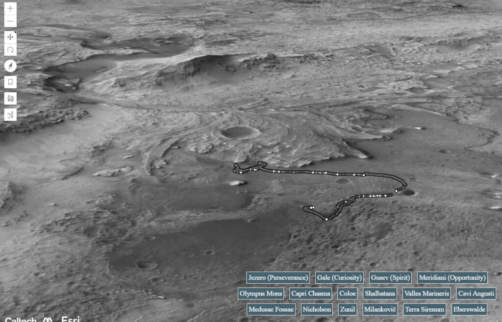
The map, which is hosted online by Caltech, provides quick access to some of the most popular sites on Mars, including its largest mountain, Olympus Mons, and the Jezero Crater, the dry bed of a lake where the Perseverance Rover mission is underway. Visitors can mark locations, measure distances, and switch between layers like mobile routes, a topographical heat map, and impact craters.
Exploring Mars from Your PC
Rich Zurek, the project scientist for the mission, said in a statement from JPL: “For 17 years, MRO has been revealing Mars like never before. This mosaic is a new and wonderful way to explore some of the images we’ve collected.” The images used in the mosaic came from the MRO’s Context Camera (CTX), which regularly observes the Martian surface as the orbiter orbits the planet.
A New Way to Explore the Red Planet
The mosaic was algorithmically stitched together, and anything the computer couldn’t contextualize was added manually. With its vast amount of data, the map offers a unique way to explore the Red Planet from the comfort of your own home.
LINK TO NASA CALTECH MAP

murray-lab.caltech.edu